
")


Geography
Enhanced Geo Visualization »
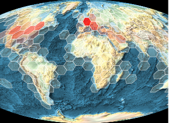
Mathematica Version 11 brings even more flexibility and power to geographic visualization. The new outlines of continents and countries, satellite imagery, and support for independent sources of geo tiles make it easy to create custom appearances for maps. More than a hundred new projections have been added to the system, highlighting specialized features and preserving geometric properties. New primitives make it easy to draw common geographic regions. View the distribution of geographic locations by grouping them into larger regions. Easily adjust maps by changing the background or projection, or even combine multiple maps. Interactive maps allow panning and zooming to see the big picture or fine details.
Geo Computation »
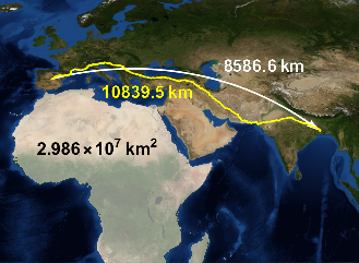
Mathematica Version 11 improves and extends the functionality for geo computation and geophysics. There are new functions to compute geodetic lengths and areas, new functions to compute travel instructions and estimations of their length and duration, and new functions to compute properties of the Earth's gravitational and magnetic fields. There is also a large collection of new cartographic projections, as well as new datums for the Earth. All together, the new geo functions provide very large computational power in general problems of geodesy and geophysics.
Geo Data »
With Mathematica Version 11, the Wolfram Geo framework continues expanding its knowledge base of geo-related information, including new types of entities, new types of map backgrounds, geophysics data, new geo projections, and much more. All this, together with the extended functionality for geo visualization, makes exploring all kinds of interesting data about society, the world, and other planets even easier.